The Hancock-Henderson Quill, Inc.
The Mississippi River sits at 21.52 feet at Burlington, IA on Tuesday, May 7, over 6 feet above flood stage (15 feet). The river crested on Friday at 23.54 feet, around 2 feet short of the 1993 flood (25.10) and the 2008 flood (25.73), when the levee in Henderson County broke near Carthage Lake.
The river continues to slowly fall from the crest on Friday. However, the National Weather Service predicts that the river will remain above 20 feet in Burlington through at least the middle of next week. That will make it 2 months with the river being over flood stage when it hit 15.49 feet back on March 15.
Cindy Brown, Henderson County Emergency Manager, believes that the river will remain above flood stage until early June. The river being above flood stage for such a long period of time, and the high amount of rain that has been falling and that remains in the forecast is a cause of concern for the levee.
"There has been some seepage in Gulfport and a few boils on the levee, but nothing that we haven't seen before when the water gets this high," reports Brown. The Henderson County Drainage Districts 1 and 2 will continue to monitor the levee several times per day.
Highway 164 between Gladstone and Oquawka was reopened by the state on Monday, May 6. Water covered both lanes on Wednesday leading to its closure.
The Carman Blacktop remains closed as it is still covered in water. Brown said the river will have to fall below 20 feet at Burlington before the roadway would be able to be cleaned. There was no timetable at this moment for its reopening.
Updates on the flooding and road closers can be found on the Henderson County Health Department's Facebook Page.
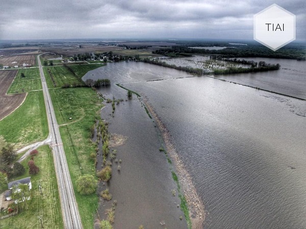
A swollen Mississippi River flows under the Great River Bridge at Burlington, IA. Phtoto courtesy of Thye Inghram Aerial Imagery.
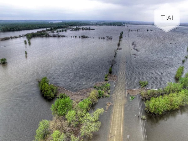
Flood waters fill up fields just north of Carman
Left: View North of Carman Road still submerged in water.
Phtotos courtesy of Thye Inghram Aerial Imagery.